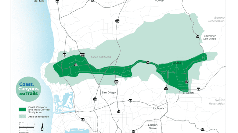
SANDAG and Caltrans are developing a Comprehensive Multimodal Corridor Plan (CMCP) for the Coast, Canyons, and Trails corridor.
The Coast, Canyons, and Trails CMCP aims to guide the development of an innovative transportation network, transforming the way people and goods move east and west through the central San Diego region. This CMCP evaluates all travel modes and transportation facilities in the Coast, Canyons, and Trails study area and tailors solutions for the travel needs of the corridor. The study aims to integrate these modes to provide a seamless travel experience.
The study area includes the cities of San Diego, Santee, and El Cajon, as well as the County of San Diego. Major transportation facilities in the study area include SR 52, portions of SR 67, and their connections with I-5, I-8, I-805, SR 163, I-15, and SR 125. Existing transit services include the Green and Orange Line Trolley and multiple local bus routes. This corridor connects two major Employment Centers – Kearny Mesa and University City/Sorrento Valley – with East San Diego County and provides connections to activity centers including Marine Corps Air Station Miramar, universities, and shopping centers.
Completing the CMCPs will help the San Diego region compete for local, state, and federal funds, including SB 1. The Coast, Canyons, and Trails Corridor Plan is anticipated to be finalized by late 2021.
Get more information and provide your feedback at sandag.mysocialpinpoint.com/coastcanyonstrails


